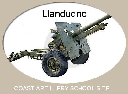
| The Coast Artillery School Site At Llandudno |
The
Royal Artillery moved its Coast Artillery School (CAS) to a site
on the
west side of
the Great Orme early in WW2; it had earlier been at Shoeburyness in
Essex but was thought to be too vulnerable to enemy attack.
The
CAS complex at Llandudno was constructed very
quickly in 1940 by a contractor - local people say it
appeared in 24 hours. Though this seems unlikely, as there were 47 buildings recorded. (Details of the
construction would have been closely guarded but the goings-on would
have been highly interesting to local people!). However, the result was
an
extraordinary example of military
deception: the group of buildings was made to ressemble a village.
For instance the Control Tower was made to look like a church tower.
There are two information boards about the site; one is situated on the left soon after you enter the site while the other board is situated high above CAS on Marine Drive, the toll road which circles the Great Orme. An information board showing the location of the remaining buildings on the site and the paths leading to them would be invaluable. (Authorities, please note!). For more detailed information about the history of the site, see the History Points pages by clicking the gunnery school site .
After complaints from local residents in 2021, the Conway Countryside Service gained permission from the Mostyn Estate to cut back on the rampant growth. Just before Xmas 2021, much clearing of the brambles etc was carried out, which has enabled visitor access to the buidings once again. A surprising number of people visit the site; some have travelled a long way to walk there and many have memories of exploring the site when they were young. Interesting memories too.
Where is the Coast Artillery School site?
The CAS site is not too easily found and there is a stramge reluctance to publicise the site. This is a shame as the place could be a good addition to Llandudno's tourist offer. It is well worth a visit. Access to the site is only possible on foot or by bicycle, using a narrow private lane with no parking spaces and with no areas for turning. Leave the car at home - though one person who visits the site frequently said he thought the ammunition huts space would make a good carpark. He has a point. Surely another great improvement would be a footpath signpost on Marine Drive pointing to this fascinating site?
From the town centre, CAS is a two and a half mile walk. Or park on the West Shore area for a shorter walk (about a mile or just over). From the West Shore, walk with the sea on your left and continue past the Toll House on the right. The Great Orme is on the right as well. The road rises steadily. After about a mile, turn left into Llys Helig Drive, a narrow private lane. Admire the large properties on your left - locally the road is known as Millionaires' Row. Cliff Richards once owned a house here, as did Neville Southall, the former Everton goalkeeper. At the end of the drive there is a gate across the road: on the other side of the gate is the Coast Artillery School site. You can pass round the gate on foot, on a bicycle or on a mobility scooter, but not by car. When walking along the narrow lane to the CAS, try and picture the large number of army lorries trundling up and down or the squads of men marching along - probably singing something rousing or more likely ribald! The men were billetted in town so there was a huge amount of traffic twice a day.
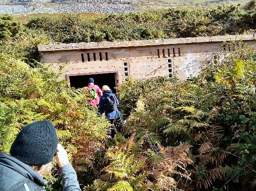
Path down to the searchlight huts
Photo Judith Morris
What CAS buildings remain to be seen? (see rough sketch below)
There are two information boards about the site; one is situated on the left soon after you enter the site while the other board is situated high above CAS on Marine Drive, the toll road which circles the Great Orme. An information board showing the location of the remaining buildings on the site and the paths leading to them would be invaluable. (Authorities, please note!). For more detailed information about the history of the site, see the History Points pages by clicking the gunnery school site .
The
official name for the site is Royal
Artillery Coastal Artillery School site.
This is a mouthful, so
people often call it the Gunnery School site.This website though calls
it the CAS for short - Coast Artillery School. The artillery/gunnery name is perhaps
misleading
since there was also training in search light use, range finding,
wireless operation and use of radar. And an amazing number of men
passed
through the site: around 20,000 men in total. As well as learning
how to repair, dismantle and service their equipment, they were given
fitness drills and also combat training.
The use of Radar
Radar was being developed during the war and the Orme played its part. Near the Rest and Be Thankful Cafe is a concrete road leading higher up on the Orme. At the end of this road was a top secret three story building with an antenna on its roof. This buiding was nicknamed Hatters Castle by local people but the miltary authorities called it X3. For more information, read the article Radar on the Orme:Hatters Castle. This can be found on the webpages of the Great Orme Exploration Society at www.goes.org.uk. Look under the Library tab and then look for the Index to the Journals, The article appeared in the Journal 2018:1:18.
George Robson, who trained on fitting radar sets in aircraft during the war, remembers that training courses ran 24 hours a day 7 days a week. Pilots told him the sets were no bloody use; they didn't bother with them and not to waste his time fitting the equipment. The erks would return in a couple of months to remove the radar set and replace it with the latest version developed by the boffins.
Today, there are interesting remains which
should be better looked after and preserved for future generations to
explore. Local people have had to cut through brambles to get to some
of the buildings - and this should not be necessary. This was in Autumn
2021. An information board was also totally hidden by brambles until
local residents cut the brambles away. The authorities should be able
to
look after the site to a higher standard than this. Keep your fingers
crossed. Some of the buildings unfortunately have been defaced with
graffiti but after 70 years of secluded existence this is not
surprising.
Regrettably in June 2024, some clown painted graffiti all over the near
search lights. Decided not to show photos of this, in order NOT to
encourage this disgraceful vandalism.The use of Radar
Radar was being developed during the war and the Orme played its part. Near the Rest and Be Thankful Cafe is a concrete road leading higher up on the Orme. At the end of this road was a top secret three story building with an antenna on its roof. This buiding was nicknamed Hatters Castle by local people but the miltary authorities called it X3. For more information, read the article Radar on the Orme:Hatters Castle. This can be found on the webpages of the Great Orme Exploration Society at www.goes.org.uk. Look under the Library tab and then look for the Index to the Journals, The article appeared in the Journal 2018:1:18.
George Robson, who trained on fitting radar sets in aircraft during the war, remembers that training courses ran 24 hours a day 7 days a week. Pilots told him the sets were no bloody use; they didn't bother with them and not to waste his time fitting the equipment. The erks would return in a couple of months to remove the radar set and replace it with the latest version developed by the boffins.
After complaints from local residents in 2021, the Conway Countryside Service gained permission from the Mostyn Estate to cut back on the rampant growth. Just before Xmas 2021, much clearing of the brambles etc was carried out, which has enabled visitor access to the buidings once again. A surprising number of people visit the site; some have travelled a long way to walk there and many have memories of exploring the site when they were young. Interesting memories too.
Where is the Coast Artillery School site?
The CAS site is not too easily found and there is a stramge reluctance to publicise the site. This is a shame as the place could be a good addition to Llandudno's tourist offer. It is well worth a visit. Access to the site is only possible on foot or by bicycle, using a narrow private lane with no parking spaces and with no areas for turning. Leave the car at home - though one person who visits the site frequently said he thought the ammunition huts space would make a good carpark. He has a point. Surely another great improvement would be a footpath signpost on Marine Drive pointing to this fascinating site?
From the town centre, CAS is a two and a half mile walk. Or park on the West Shore area for a shorter walk (about a mile or just over). From the West Shore, walk with the sea on your left and continue past the Toll House on the right. The Great Orme is on the right as well. The road rises steadily. After about a mile, turn left into Llys Helig Drive, a narrow private lane. Admire the large properties on your left - locally the road is known as Millionaires' Row. Cliff Richards once owned a house here, as did Neville Southall, the former Everton goalkeeper. At the end of the drive there is a gate across the road: on the other side of the gate is the Coast Artillery School site. You can pass round the gate on foot, on a bicycle or on a mobility scooter, but not by car. When walking along the narrow lane to the CAS, try and picture the large number of army lorries trundling up and down or the squads of men marching along - probably singing something rousing or more likely ribald! The men were billetted in town so there was a huge amount of traffic twice a day.
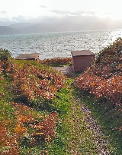
Path down to the searchlight huts
Photo Judith Morris
What CAS buildings remain to be seen? (see rough sketch below)
1 Footprint of ammunition store huts. Today this is the
most
easily noticed facility on the site. Originally there were about 15
nissan huts here, but today this footprint of the ammunition huts is
the
largest remnant on
the site being approx 60 yards long. There was a water tank in case of fire and probably a blast wall screened the site.
2 Metal bolts in the ground forming a circle which was part of a gun emplacement. These (before they were levelled) were large constructions made of concrete. They were raised from the ground to give them some elevation for sighting, they were circular inconstruction and they had to carry the weight of a heavy gun which had to have room for it to be swivelled as they fired at moving targets.
3 A large concrete shelter which is easily accessed though beware of brambles. If firing the adjacent gun should attract return fire from the enemy, troops could practise retreating to the shelter. A supply of shells might also be kept in the shelter until they were ready for loading.
4 A generator house which supplied power. This is another concrete building which you can enter. Note the ventilation slits and the raised platforms for the generators. Lots of electric cabling would have spread out from it.
5 Another gun emplacement. (Same as number two in the list). In fact there were many gun emplacements.
6 A bunker set underground next to the gun emplacement mentioned above. Again soldiers could seek shelter from return fire. You can go inside the bunker if you are brave and agile but the entrance is only 3 feet high owing to silting up over the years. It was likely that the bunker was not underground originally: it was easier to bury it than to demolish it.
7 "Near" searchlight huts which you can go inside. The three huts are approached by a short path and overlook the sea. (Called the near huts as they are near the centre of the site and also to differentiate them from the far searchlight huts which are further away). Photo shown above. A close-up photo is seen when you scroll down.
8 A mystery shaft more likely to be of military use than connected with mining since it is fairly close to the centre of the military complex. However, on maps showing the copper veins on the Orme, one vein seems to be in about the right place for the mystery shaft, which has been named Keith's Mystery Shaft. Any buildings associated with possible mining activity would have disappeared during the construction of the CAS. No information has been found about the shaft. The shaft is thirty yards to the left of a wooden bench which looks out to sea. Walk on the edge of a steep bank towards town.
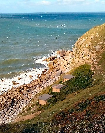
9 "Far" search light huts. These three huts have moved nearer the sea owing to a landslip. Will eventually disappear in the sea. Steep path down to them. Photo below.
10 Observation post high up above the sea. Its a good long walk from the ammunition store huts but worth it. A little scramble to get inside. Photo below.There were originally six of these observation posts. As well as looking out for possible enemy activity, the posts would be used to track the accuracy of artillery fire, the movement of artillery targets, the encroachment of fishing boats & other ships into the restricted area and the overflight of RAF aircraft on training exercises which would be at risk from artillery.
11 This number is not shown on the rough sketch below as it is not part of the Coast Artillery School site. The Cowboy Mine (sometimes called the Gunnery Adit or the Gunnery Mine) is a feature of interest to expert cavers and to mining enthusiasts. It is not shown on the sketch below as it is regarded as dangerous to explore. It gets a mention though because it is an interesting feature of the area. No information on the mine has been found, but in Jan 2022 UCET revealed that it leads to a cavern with three routes going off.
A video of the Coast Artillery School
A YouTube video by Day Hughes is available giving a view of the buildings on the site. He shows the interior of the buildings as well. Please click here to view the video. The video actually begins at the West Shore and walks very slowly to all the CAS buildings listed here and explores inside them all. Eventually ... it goes to the Cowboy Mine. Day Hughes' video is long and somewhat idiosyncratic but well worth watching.
It is very probable that other interesting features remain hidden by mounds of earth and by vegetation. When in the mid 1950s the council inspected the site with a view to demolition, they estimated there were 47 buildings on the site with roughly half of them "submerged or partly submerged with vegetation." It was cheaper just to leave them or cover them rather than demolishing them. So they are probably still there! Mind as explosives were used perhaps nothing remains? Today there are some flat areas where nothing much grows - a sign that soil or rubble covers something buried. However, you can't explore anything you suspect may be there underground because digging is not allowed. A possible solution might be a LIDAR survey which would use ground penetrating radar to reveal what is down there. Typical costs (in 2024) are about £3,000 for a 10 hectare site. How about it ?
A major problem with the site is its management. The landowner is the Mostyn Estate which also owns the private lane which leads to the site. Management of the area rests with Conway Countryside Service. In 2011, the site became An Ancient Monument which means that CADW have a duty to preserve the buildings. (Grants could be available from CADW to protect the remaining buildings). The site is also a Site of Special Scientific Interest which means that Natural Resources Wales also have an interest in the site. With so many different players involved, it is no wonder that progress in looking after the site is very difficult.
Most of the CAS buildings were demolished around 1956, but when the Artillery School left in the middle 1940s, the buildings were inhabited by people who had lost their homes in bombing raids in Liverpool. They were not squatters as they paid rent to the council. Transport was also provided by the council to take children to and fro from school.
Practice firing of a big gun
Back in 2011, Conwy Council produced an excellent illustrated, bi-lingual leaflet about the gunsite. The leaflet was written by Philip C. Evans, an expert on the Coast Artillery School. Philip's work has much essential information about the CAS and includes some interesting photos. A diagramn shows the location of all the buildings which were constructed in 1940. The diagramn shows the position of five observation posts, two engine houses, a command post, a control tower, a guard shelter, two searchlight batteries, a power house, two gun stores, an ammunition store, workshops, a generator house and buildings for wireless and radar. And of course there were gun emplacements for artillery equipment which were used for training. At the height of the war, approx 700 people were in training at the site. Most of the personnel were billetted in town but clearly the buildings would need a heavy guard presence 24 hours a day. Philip's leaflet is free and is available from the Home Front Museum on New St and also Llandudno Museum .
Another source showed among other things six gunnery positions, kitchens and two toilet blocks.
No maps have shown the existence of the necessary canteens, lecture rooms, offices, guard houses, garages and trenches. As well as being trained in their specialisations, men were also trained in fighting and defending. If the enemy invaded or if they were posted abroad, they would have great need of battlefield skills.
2 Metal bolts in the ground forming a circle which was part of a gun emplacement. These (before they were levelled) were large constructions made of concrete. They were raised from the ground to give them some elevation for sighting, they were circular inconstruction and they had to carry the weight of a heavy gun which had to have room for it to be swivelled as they fired at moving targets.
3 A large concrete shelter which is easily accessed though beware of brambles. If firing the adjacent gun should attract return fire from the enemy, troops could practise retreating to the shelter. A supply of shells might also be kept in the shelter until they were ready for loading.
4 A generator house which supplied power. This is another concrete building which you can enter. Note the ventilation slits and the raised platforms for the generators. Lots of electric cabling would have spread out from it.
5 Another gun emplacement. (Same as number two in the list). In fact there were many gun emplacements.
6 A bunker set underground next to the gun emplacement mentioned above. Again soldiers could seek shelter from return fire. You can go inside the bunker if you are brave and agile but the entrance is only 3 feet high owing to silting up over the years. It was likely that the bunker was not underground originally: it was easier to bury it than to demolish it.
7 "Near" searchlight huts which you can go inside. The three huts are approached by a short path and overlook the sea. (Called the near huts as they are near the centre of the site and also to differentiate them from the far searchlight huts which are further away). Photo shown above. A close-up photo is seen when you scroll down.
8 A mystery shaft more likely to be of military use than connected with mining since it is fairly close to the centre of the military complex. However, on maps showing the copper veins on the Orme, one vein seems to be in about the right place for the mystery shaft, which has been named Keith's Mystery Shaft. Any buildings associated with possible mining activity would have disappeared during the construction of the CAS. No information has been found about the shaft. The shaft is thirty yards to the left of a wooden bench which looks out to sea. Walk on the edge of a steep bank towards town.
9 "Far" search light huts. These three huts have moved nearer the sea owing to a landslip. Will eventually disappear in the sea. Steep path down to them. Photo below.
10 Observation post high up above the sea. Its a good long walk from the ammunition store huts but worth it. A little scramble to get inside. Photo below.There were originally six of these observation posts. As well as looking out for possible enemy activity, the posts would be used to track the accuracy of artillery fire, the movement of artillery targets, the encroachment of fishing boats & other ships into the restricted area and the overflight of RAF aircraft on training exercises which would be at risk from artillery.
11 This number is not shown on the rough sketch below as it is not part of the Coast Artillery School site. The Cowboy Mine (sometimes called the Gunnery Adit or the Gunnery Mine) is a feature of interest to expert cavers and to mining enthusiasts. It is not shown on the sketch below as it is regarded as dangerous to explore. It gets a mention though because it is an interesting feature of the area. No information on the mine has been found, but in Jan 2022 UCET revealed that it leads to a cavern with three routes going off.
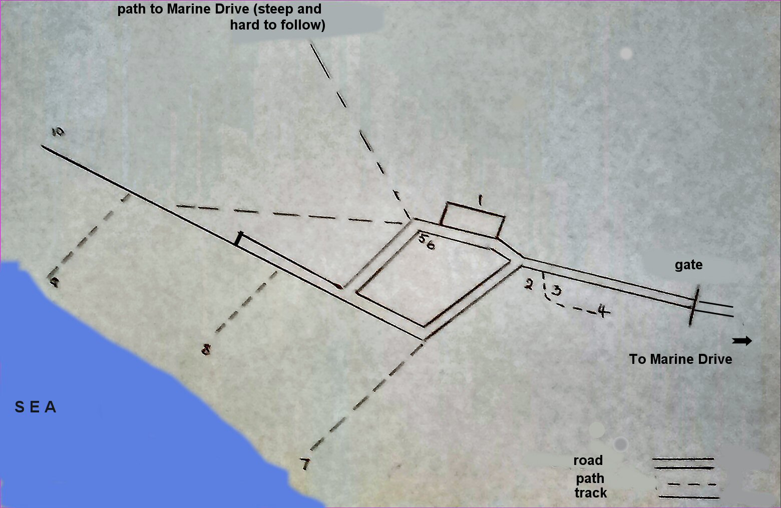
ROUGH SKETCH OF THE
SITE - DRAWN BY KEITH MORRIS
(Not to scale - and with apologies for any inaccuracies!)
The numbers on the plan refer to the Remaining Buildings List (see above)
(Not to scale - and with apologies for any inaccuracies!)
The numbers on the plan refer to the Remaining Buildings List (see above)
A video of the Coast Artillery School
A YouTube video by Day Hughes is available giving a view of the buildings on the site. He shows the interior of the buildings as well. Please click here to view the video. The video actually begins at the West Shore and walks very slowly to all the CAS buildings listed here and explores inside them all. Eventually ... it goes to the Cowboy Mine. Day Hughes' video is long and somewhat idiosyncratic but well worth watching.
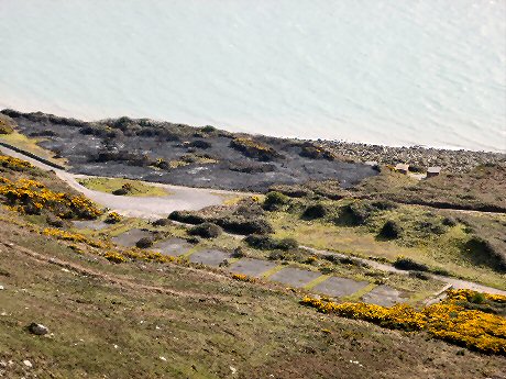
A
view of the site from Marine Drive photographed by Dave Wrennall
in 2017. In the foreground, you can see the footprints of the
ammunition store huts, while near the sea you can just make out the the
near searchlight huts. Also noticeable is an area of burnt ground.
Whether the fire was caused by hooligans or whether it was controlled
burning by the council is open to debate.
 |
|
| Near search
lights
-
and far ones, almost in the sea Photos Judith Morris |
It is very probable that other interesting features remain hidden by mounds of earth and by vegetation. When in the mid 1950s the council inspected the site with a view to demolition, they estimated there were 47 buildings on the site with roughly half of them "submerged or partly submerged with vegetation." It was cheaper just to leave them or cover them rather than demolishing them. So they are probably still there! Mind as explosives were used perhaps nothing remains? Today there are some flat areas where nothing much grows - a sign that soil or rubble covers something buried. However, you can't explore anything you suspect may be there underground because digging is not allowed. A possible solution might be a LIDAR survey which would use ground penetrating radar to reveal what is down there. Typical costs (in 2024) are about £3,000 for a 10 hectare site. How about it ?
A major problem with the site is its management. The landowner is the Mostyn Estate which also owns the private lane which leads to the site. Management of the area rests with Conway Countryside Service. In 2011, the site became An Ancient Monument which means that CADW have a duty to preserve the buildings. (Grants could be available from CADW to protect the remaining buildings). The site is also a Site of Special Scientific Interest which means that Natural Resources Wales also have an interest in the site. With so many different players involved, it is no wonder that progress in looking after the site is very difficult.
Most of the CAS buildings were demolished around 1956, but when the Artillery School left in the middle 1940s, the buildings were inhabited by people who had lost their homes in bombing raids in Liverpool. They were not squatters as they paid rent to the council. Transport was also provided by the council to take children to and fro from school.
| It
is said that one family, fed up with using candles or oil lamps, ran a cable along
the ground and got free electricity through by-passing a meter. All was
well
for a while but a combination of a puddle and a badly insulated cable
joint eventually caused a loss of power and a lethal shock to an
unfortunate passing
sheep. Though the poor creature did keep the family supplied with lamb chops.... Info from the Three Towns Forum |
~ ~ ~ ~
Practice firing of a big gun
There
were at least six different sizes of guns for the soldiers to fire. The largest
gun was 9.5 inches and had an impressive range of 18.75 miles
reaching Puffin Island, Anglesey. The navy had raised a sunken ship,
the Gambhira,
and towed it from Scapa Flow to Puffin Island to be used
as a target. The gunners of Llandudno were well trained though and soon
the Gambhira was sunk to the bottom of the ocean again! Other targets
were simply towed by motor torpedo boats across the bay for the gunners
to use as targets. (Perilous occupation for the guys piloting the mtbs!)
Another training method was to fire at De Havilland Tiger Moths
launched into the air from airfields on Anglesey. Known as Queen Bees
(because of the noise?), these were remote controlled aircraft
specially built with lighter materials. Launched by catapults
apparently.
When the big guns were being fired, all of Llandudno town knew about it and local people reported their windows sometimes rattled! Remember too that night firing of guns also took place - the enemy did not just operate 9 - 5. The boom of guns and the sweep of search lights would have been quite something to see and hear. It is thought that among the guns were five 6" guns, a 4" battery, 6" naval guns, a 4.5" anti-aircraft gun, one twin 6 pounder, a six pounder Director and three 12 pounder quick fire guns.
Built in 1919, the Gambhira was a 5,000 ton cargo ship which was scuttled in 1939 at Scapa Flow in order to block a channel. It was towed to this area for target practice in 1943 and was sunk by artillery fire on October 15th 1943. The wreck is located near Puffin Island and is still there though explosives were used to break up the wreck which is now scattered over a large area. The largest pieces stand 20 feet above the sea bed.
Photos of the Coast Artillery School
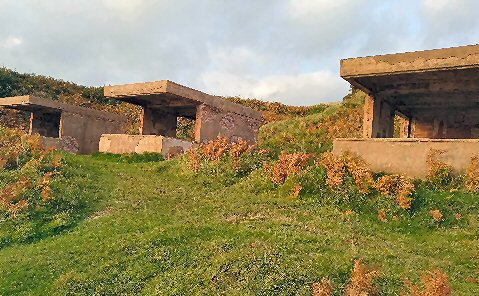
generator house
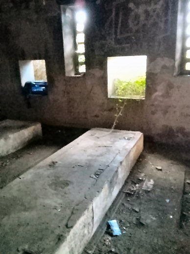
Photos Judith Morris
The generator house would have
supplied power to the whole of the complex and cables would have run
off in all directions. Probably the cables were laid above ground, but
if they were sunk in trenches, they are probably still there.
Photos Judith Morris
Back in 2011, Conwy Council produced an excellent illustrated, bi-lingual leaflet about the gunsite. The leaflet was written by Philip C. Evans, an expert on the Coast Artillery School. Philip's work has much essential information about the CAS and includes some interesting photos. A diagramn shows the location of all the buildings which were constructed in 1940. The diagramn shows the position of five observation posts, two engine houses, a command post, a control tower, a guard shelter, two searchlight batteries, a power house, two gun stores, an ammunition store, workshops, a generator house and buildings for wireless and radar. And of course there were gun emplacements for artillery equipment which were used for training. At the height of the war, approx 700 people were in training at the site. Most of the personnel were billetted in town but clearly the buildings would need a heavy guard presence 24 hours a day. Philip's leaflet is free and is available from the Home Front Museum on New St and also Llandudno Museum .
Another source showed among other things six gunnery positions, kitchens and two toilet blocks.
No maps have shown the existence of the necessary canteens, lecture rooms, offices, guard houses, garages and trenches. As well as being trained in their specialisations, men were also trained in fighting and defending. If the enemy invaded or if they were posted abroad, they would have great need of battlefield skills.
The surviving observation post
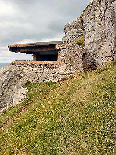
Photo Judith Morris
The Little Orme
The CAS also had a practice site on the Angel Bay side of the Little Orme. This was called the Coast Artillery Practice Camp. The site was also the home of the Coast Artillery Searchlight Camp. The camps were in use from May 28th 1842 to Dec 1843, though some limited use of gun testing continued afterwards. A total of 8,500 men were trained at the site. If you go through the gate leading to the disused quarry in Angel Bay, veer left towards the cliffs. There are the nondescript foundations for several military buildings remaining there. From 1951 there was talk of demolition of the buildings, but the site wasn't completely cleared until 1972.
When the site was built, some of the old quarry buildings were re-used. Nissan huts were built on the site while both temporary buildings and permanent structures were erected. Buidings recorded were: two observation posts, a wireless hut, offices, an engine room, a fitters shop, a lecture room, two gun stores, a changing room, a guard room, two searchlight huts, a radar establishment and a large magazine. No mention is made of the canteen, kitchens and ablutions block which must have been there. Wonder if use was made of the wharf which the quarrymen had built? It seems unlikely that this facility would have been ignored. Does anybody out there have any views on this?
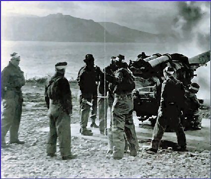
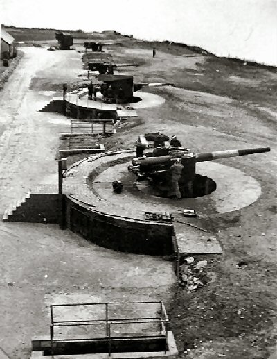
The photo below apparently shows the big guns in use at the Little Orme. Note the safety railings round the underground bunkers. (This photo is now discovered to be on the Great Orme and not on the Little Orme. It shows 6" inch guns. The photo is said to be from the National Archives).
A local resident remembers that, as a boy, he explored pill-boxes and bunkers near the cliffs overlooking the sea. All disappeared into the sea! He estimated that perhaps 50 yards of land had been claimed by the sea. Wonder if they were pill boxes - maybe they were the searchlight buildings or the observation posts?
~~~~~~~~~~~~~~~~~~~~~~~~~~~~~~~~~~~~~~~~~~~~~~~~~~~~~~~~~~~~~~~~~~~~~~
BYELAWS FOR THE COAST ARTILLERY SCHOOL
On 1st March 1942, the War Office produced byelaws to be followed at the CAS site. The byelaws are lengthy and tedious to read these days but are available to read by clicking here. They are not without interest though: the positioning of the warning flags and lamps, for instance, and the wide range of authorities to be notified before firing could take place; even the titles of the individuals to be notified and their locations. All these give us a flavour of a wartime district much different from today. The CAS site had been operating for two years before the byelaws were issued. What prompted the civl servants to belatedly draw up these regulations?
* If you are interested in WW2 remains, read "LLANDUDNO'S MILITARY HERITAGE" by Peter Johnson & Adrian Hughes published in 2020 by Amberley.
* Also by Adrian Hughes, "CONWY MILITARY HERITAGE" published by Amberley 2024
* Another local book about the WW2 construction of the Mulberry harbours is "CONWY MULBERRY HARBOUR" by Mark Hughes published in 2001 by Gwasg Carreg Gwalch.
* A visit to the HOME FRONT MUSEUM on New Street, Llandudno is also a must. Experience the sights & sounds of civilian life in the Second World war. (Seasonal opening only).
* For many years, THE GREAT ORME EXPLORATION SOCIETY has been recording both the underground workings and surface features of the Great Orme. To view photos, videos and plans of the mines and to read many articles about all sorts of fascinating features of the Great Orme, please visit this wonderful website.
* World's largest prehistoric copper mine with a visitor centre and self-guided underground tour. Great Orme Mines are not to be missed. (Seasonal)
* Beautifully situated on the Great Orme and overlooking the sea, the historic St Tudno's Church has outdoor services in the summer.
Photo Judith Morris
This observation post was one of several on the CAS.
This is the only surviving one. Local people often call it The Lookout.
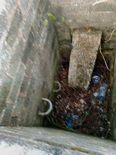
Keith's Mystery Shaft
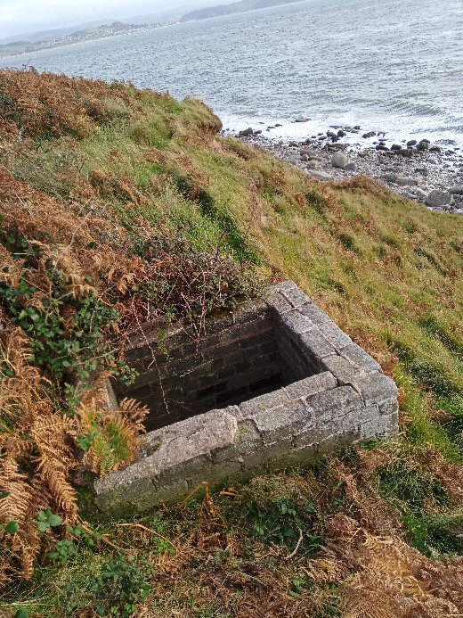
The shaft pictured below is a bit of a mystery. It was discovered by Keith Morris in 2022 and has been officially named Keith's Mystery Shaft. The photos look very like a mine shaft, but as the sea is only a few yards away, any mine workings under the sea would very likely fill with water. So any mine workings would probably go under the centre of the CAS rather than under the sea (?). If the shaft is of military use, its purpose is unknown. Was it just to give easy access to the beach? If it is a mining shaft, it pre-dates the CAS. The fact that it is centrally placed in the military site could just be a coincidence. But see the notes in the list above of the remaining buildings, namely no. 8.
Keith's Mystery Shaft
The shaft pictured below is a bit of a mystery. It was discovered by Keith Morris in 2022 and has been officially named Keith's Mystery Shaft. The photos look very like a mine shaft, but as the sea is only a few yards away, any mine workings under the sea would very likely fill with water. So any mine workings would probably go under the centre of the CAS rather than under the sea (?). If the shaft is of military use, its purpose is unknown. Was it just to give easy access to the beach? If it is a mining shaft, it pre-dates the CAS. The fact that it is centrally placed in the military site could just be a coincidence. But see the notes in the list above of the remaining buildings, namely no. 8.
The
shaft which is a mystery
Photos Judith Morris
Photos Judith Morris
The Little Orme
The CAS also had a practice site on the Angel Bay side of the Little Orme. This was called the Coast Artillery Practice Camp. The site was also the home of the Coast Artillery Searchlight Camp. The camps were in use from May 28th 1842 to Dec 1843, though some limited use of gun testing continued afterwards. A total of 8,500 men were trained at the site. If you go through the gate leading to the disused quarry in Angel Bay, veer left towards the cliffs. There are the nondescript foundations for several military buildings remaining there. From 1951 there was talk of demolition of the buildings, but the site wasn't completely cleared until 1972.
When the site was built, some of the old quarry buildings were re-used. Nissan huts were built on the site while both temporary buildings and permanent structures were erected. Buidings recorded were: two observation posts, a wireless hut, offices, an engine room, a fitters shop, a lecture room, two gun stores, a changing room, a guard room, two searchlight huts, a radar establishment and a large magazine. No mention is made of the canteen, kitchens and ablutions block which must have been there. Wonder if use was made of the wharf which the quarrymen had built? It seems unlikely that this facility would have been ignored. Does anybody out there have any views on this?
The photo below apparently shows the big guns in use at the Little Orme. Note the safety railings round the underground bunkers. (This photo is now discovered to be on the Great Orme and not on the Little Orme. It shows 6" inch guns. The photo is said to be from the National Archives).
Gun Batteries
There were several types of guns for the trainees to practice with, and their targets were towed half a mile behind a fast moving boat. There were two 12 pounder quick fire anti-aircraft guns, a twin 6 pounder quick fire gun, two 6 inch BL naval guns and two 6 inch BL land guns. There were also three different sets of rangefinders in use. Sometime later 18 Bofors guns were used (40mm) and twelve 3.7 Heavy Anti-Aircraft guns. When the training of artillery men finished, the site was still used for testing new weapons.
There were several types of guns for the trainees to practice with, and their targets were towed half a mile behind a fast moving boat. There were two 12 pounder quick fire anti-aircraft guns, a twin 6 pounder quick fire gun, two 6 inch BL naval guns and two 6 inch BL land guns. There were also three different sets of rangefinders in use. Sometime later 18 Bofors guns were used (40mm) and twelve 3.7 Heavy Anti-Aircraft guns. When the training of artillery men finished, the site was still used for testing new weapons.
A local resident remembers that, as a boy, he explored pill-boxes and bunkers near the cliffs overlooking the sea. All disappeared into the sea! He estimated that perhaps 50 yards of land had been claimed by the sea. Wonder if they were pill boxes - maybe they were the searchlight buildings or the observation posts?
~~~~~~~~~~~~~~~~~~~~~~~~~~~~~~~~~~~~~~~~~~~~~~~~~~~~~~~~~~~~~~~~~~~~~~
BYELAWS FOR THE COAST ARTILLERY SCHOOL
On 1st March 1942, the War Office produced byelaws to be followed at the CAS site. The byelaws are lengthy and tedious to read these days but are available to read by clicking here. They are not without interest though: the positioning of the warning flags and lamps, for instance, and the wide range of authorities to be notified before firing could take place; even the titles of the individuals to be notified and their locations. All these give us a flavour of a wartime district much different from today. The CAS site had been operating for two years before the byelaws were issued. What prompted the civl servants to belatedly draw up these regulations?
| OTHER LOCAL RESOURCES OF INTEREST |
* If you are interested in WW2 remains, read "LLANDUDNO'S MILITARY HERITAGE" by Peter Johnson & Adrian Hughes published in 2020 by Amberley.
* Also by Adrian Hughes, "CONWY MILITARY HERITAGE" published by Amberley 2024
* Another local book about the WW2 construction of the Mulberry harbours is "CONWY MULBERRY HARBOUR" by Mark Hughes published in 2001 by Gwasg Carreg Gwalch.
* A visit to the HOME FRONT MUSEUM on New Street, Llandudno is also a must. Experience the sights & sounds of civilian life in the Second World war. (Seasonal opening only).
* For many years, THE GREAT ORME EXPLORATION SOCIETY has been recording both the underground workings and surface features of the Great Orme. To view photos, videos and plans of the mines and to read many articles about all sorts of fascinating features of the Great Orme, please visit this wonderful website.
* World's largest prehistoric copper mine with a visitor centre and self-guided underground tour. Great Orme Mines are not to be missed. (Seasonal)
* Beautifully situated on the Great Orme and overlooking the sea, the historic St Tudno's Church has outdoor services in the summer.